Borderline
Evans Notch, New Hampshire/Maine
Proposed in the 1930s
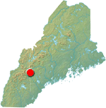 Overview
While White Mountain skiing is generally best known for areas in or near Pinkham Notch (Wildcat), Franconia Notch (Cannon), and Crawford Notch (Bretton Woods), the much more wild and remote Evans Notch was nearly home to what could have been the largest ski area in the Northeast.
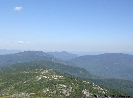
Meader and the Royces at left, Speckled at right, as seen from North Baldface (2010) |
History
With skiing quickly gripping the region, the high peaks of the White Mountains were looked at in a new way. Shortly after the Civilian Conservation Corps completed a road through Evans Notch, the Appalachian Mountain Club and United States Forest Service looked into winter use for the area.
In 1936, the Borderline proposal was released to the public. Though much of the terrain in the proposal was located in New Hampshire, it was thought to be a Maine project, as either end of the project was based in Maine towns (Fryeburg was expected to be a 'gateway').
Predating the Cannon Tramway and Mt. Rowe Chairlift, the project was to be hike-up-ski down. Had the project been completed, one can theorize that lifts would not have been far behind it.
The initial proposal called for trails on Kearsarge North Mountain, Eastman Mountain, South Baldface, Mt. Meader, West Royce Mountain, East Royce Mountain, and Speckled Mountain. The overall vertical drop of the project would have been in excess of 3,000 feet, with South Baldface being the highest peak at 3,570 feet. The AMC Cold River Camp, located near the foot of South Baldface, would have served as a popular base camp. The Civilian Conservation Corps were considered a possibility for labor.
Subsequent northward expansion was expected for Caribou Mountain, Elizabeth Mountain, Haystack Mountain, Peabody Mountain, and Pickett Henry Mountain.
It is thought the proposal lost steam with the development of nearby lift served areas (such as Cranmore), the destruction from the hurricane of 1938, and questionable snow-retaining abilities of some of the named peaks.

A 1980s USGS map of the core of the Borderline proposal
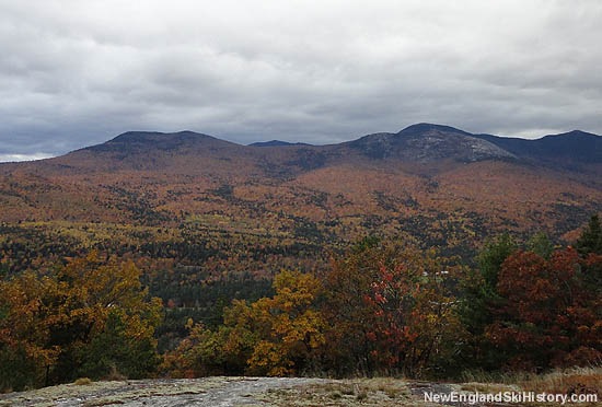
Eastman Mountain and South Baldface as seen from Little Deer Hill (2010)
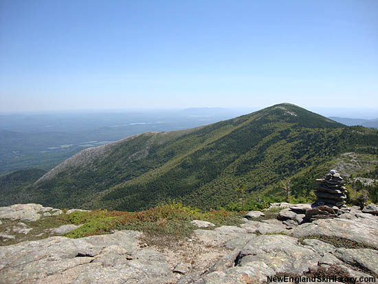
South Baldface as seen from North Baldface (2010)
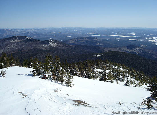
Looking east on Kearsarge North Mountain (2008)
Today
There are no known remains of the Borderline proposal. It is highly unlikely that any part of it will ever be developed for skiing at this juncture.
Quotes
| " |
What promises to be one of the most intensive ski trail developments in New England, one that will open up an entirely new territory for winter sports enthusiasts, is planned for the White Mountain National Forest on the Maine-New Hampshire borderline between Gilead and Fryeburg. The U. S. Forest Service, Appalachian Mountain Club, and the various towns in the region are cooperating in the project which will open ski trails on seven border mountains in Maine and New Hampshire.
|
" |
|
Ran Sanford, 1936
| |
| " |
The Appalachian Mountain Club has a private camp located just across the border in Chatham, N. H. Persons familiar with the region predict that this camp, known as the Cold River Camp, may rival the famous Pinkham Notch Camp of the A. M. C. when the borderline development reaches completion.
|
" |
|
Ran Sanford, 1936
| |
| " |
There is no limit to the number of sporty trails that can be constructed in the region, with government funds and labor available since the land is all in the White Mountain National Forest. Baldface Mountain offers a chance for a ski trail that will rival the internationally famous Tuckermanís Ravine Trail on Mount Washington.
|
" |
|
Ran Sanford, 1936
| |
| " |
At the northern terminus of the Evans Notch Road are Gilead and Bethel. At the southern end of the regions is Fryeburg, already a bustling winter sports town. Fryeburg promises to profit from its advantageous position as the last town of any size en route to the borderline region from either Boston or Portland and has named a committee to work with the U. S. Forest Service and Appalachian Mountain Club in their efforts to open up the territory to winter sports.
|
" |
|
Ran Sanford, 1936
| |
| " |
The winter of 1936 was also notable for one bold, out-of-the-box idea that never came to fruition: a joint proposal by the Appalachian Mountain Club and the U.S. Forest Service for a network of ski trails in the Evans Notch region.
|
" |
|
Conway Daily Sun, 2010
| |
| " |
"Although lifts were not included in the original proposal, this scheme could have been the forerunner for a vast and sprawling ski resort that far exceeds anything in New England today. It'd hard to believe that 75 years ago a ski development on the scale of Big Sky, Heavenly, or Vail was seriously proposed for the Maine-New Hampshire border region!
|
" |
|
Scott Andrews, 2010
| |
Resources
Andrews, Scott. Research Director - Ski Museum of Maine
Caribou Mountain - FranklinSites.com Hiking Guide
Eastman Mountain - FranklinSites.com Hiking Guide
Kearsarge North Mountain - FranklinSites.com Hiking Guide
Mt. Meader - FranklinSites.com Hiking Guide
East Royce Mountain - FranklinSites.com Hiking Guide
West Royce Mountain - FranklinSites.com Hiking Guide
Sanford, Ran. "Borderline Development To Open Up Many New Ski Trails." Portland Evening Express. 14 Jan. 1936. Courtesy Scott Andrews.
"Ski Museum of Maine Night slated today; Fryeburg Academy Ski Team hosting" Conway Daily Sun. 04 Nov. 2010.
South Baldface - FranklinSites.com Hiking Guide
Speckled Mountain - FranklinSites.com Hiking Guide
Last updated: November 26, 2012
|
|


