Mt. Grace
Warwick, Massachusetts
| Overview |
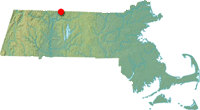
Located east of the Connecticut River in northern Massachusetts, Mt. Grace was once home to multiple downhill ski trails, as well as a rope tow area. It is not known exactly when the trails were cut or when they were abandoned, however downhill skiing of one form or another was likely available from the 1930s to the 1970s. The CCC was involved with ski development on the mountain in the mid to late 1930s.
| |
| Trails on Mt. Grace |
 Pro Ski Trail - Abandoned
The Pro Ski Trail was likely cut by the CCC and dropped about 1,000 vertical feet over the course of a mile.
Pro Ski Trail - Abandoned
The Novice Ski Trail was likely cut by the CCC and dropped about 740 vertical feet over the course of 8/10th of a mile.
| |
| Quotes |
| " |
CCC workers have done a rush job on trail clearance in Mount Grace State Forest at Warwick, Mass.
|
" |
|
Marshall Sprague, The New York Times, 1938
| |
| " |
Warwick--Complete skiing facilities in Mount Grace State Forest.
|
" |
|
The New York Times, 1939
| |
| " |
Mount Grace State Forest
Championship racing course, excellent novice open slopes, trails. Three large parking areas. Adirondack shelter, fireplaces, drinking water. Loc. six miles from Orange, which is served by Boston & Maine Railroad.
|
" |
|
Massachusetts Ski Guide, 1950
| |
| |
| Images |

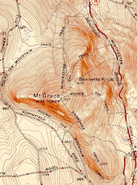
1946 USGS map showing Mt. Grace
|
|
| Resources |
Massachusetts Ski Guide 1950. Boston, MA: Massachusetts Development and Industrial Commission, 1950.
Mt. Grace - FranklinSites.com Hiking Guide
Mount Grace - New England Lost Ski Areas Project
Mount Grace - Wikipedia
Mount Grace State Forest - Massachusetts DCR
Sprague, Marshall. "New Trails Beckon To Skiers" The New York Times. 4 Dec. 1938.
"Vast Network Of Trails Ready For Skiers" The New York Times. 10 Dec. 1939.
Last updated: May 7, 2013
| |
|


